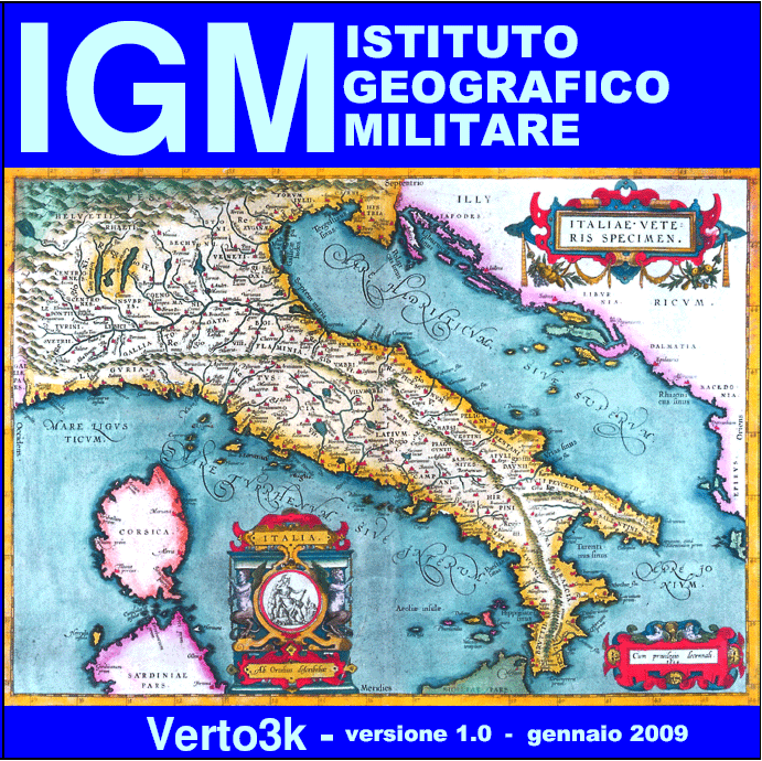
Verto3K: chiave hardware
-
Disponibilita'

- Accedi al sito per procedere con l'acquisto
Versione italiana - English version
Il programma ed il manuale sono scaricabili gratuitamente ma per poter essere utilizzato il software Verto3k richiede una chiave hardware, che, acquistata on line, verrà spedita tramite corriere.
Verto3k consente (come Verto 2k) la conversione di coordinate fra i Sistemi Geodetici di Riferimento più comunemente utilizzati oggi in Italia (ROMA40, ED50, ETRF89 e ETRF2000) in tutte le possibili combinazioni. Oltre alle coordinate geografiche il programma consente di trattare anche coordinate piane appartenenti ai Sistemi Cartografici normalmente associati ai Sistemi Geodetici suddetti: Gauss-Boaga per ROMA40, UTM per ED50, e UTM e Fuso Italia per le realizzazioni del Sistema Globale.
Per quanto riguarda la componente altimetrica Verto3k permette la trasformazione di quote ellissoidiche, riferite all’ellissoide geocentrico GRS80, in quote geoidiche (sul livello del mare), relative ai riferimenti altimetrici nazionali, e viceversa.
Rispetto a Verto2k, Verto3k comprende funzionalità aggiuntive: disponendo di un adeguato numero di punti doppi, cioè noti in due sistemi anche definiti dall’utente, permette la determinazione delle relazioni geometriche intercorrenti fra i due riferimenti, nella forma di parametri di rototraslazione sia spaziali che piani; sono disponibili infine anche apposite funzionalità che consentono l’applicazione dei parametri suddetti.
Nel programma, con la stessa logica di Verto2k, sono memorizzati solo gli algoritmi necessari ad eseguire le trasformazioni, ma non i dati, che devono essere acquistati separatamente, nella forma di porzioni di grigliato memorizzate in file con le seguenti estensioni:
- *.gk1: consentono le trasformazioni di quote utilizzando il modello di geoide ITALGEO99;
- *.gk2: consentono le trasformazioni di quote utilizzando il modello di geoide ITALGEO2005.
Tali porzioni di grigliato sono disponibili in due tagli:
- a copertura di ciascuno dei fogli della carta d'Italia alla scala 1:50.000 (circa 600 kmq), identificati con il numero del foglio;
- come intorno di ciascuno dei punti IGM95 (circa 300 kmq), indicati con il numero del punto.
Verto3k consente di proiettare un punto in un fuso diverso da quello di appartenenza, e permette, limitatamente alle conversioni all’interno dello stesso Sistema di Riferimento, di operare fuori della griglia selezionata. Con Verto3k è quindi possibile, anche senza disporre dei file “*.gk?”, la trasformazione fra coordinate geografiche e coordinate piane dello stesso Sistema su tutto il territorio nazionale. Inoltre ai Sistemi Globali ETRF è stato associato, in aggiunta all’UTM, il “Fuso Italia”, che permette di ottenere la proiezione di tutto il territorio nazionale su un unico piano senza soluzioni di continuità.
Verto 3k consente sia l’input da tastiera, con output su monitor, sia il trattamento di file in formato testo o in formato MS-Excel (*.xls), e fornisce risultati, nello stesso formato di input, identici a quelli ufficialmente adottati dall’IGM.
Il software Verto3k è un’evoluzione di Verto3, rimasto in vendita fino al 2008, al quale è stata aggiunta la realizzazione ETRF2000(2008.0) del Sistema di Riferimento Globale ETRS89. Nelle precedenti versioni il Sistema di Riferimento globale era presente nella realizzazione ETRF89, indicata, non del tutto propriamente, con l’acronimo “WGS84”. Tale dicitura era stata scelta per indicare il Sistema Globale, perché più comune; d’altra parte non erano possibili errori: l’unica realizzazione del Sistema Globale realmente utilizzabile sul territorio nazionale, costituita dalla rete IGM95, era espressa, fino ad oggi, nella realizzazione ETRF89. Nella presente versione l’introduzione di un’altra realizzazione ha obbligato ad indicare ciascuna col proprio nome specifico: ETRF89 per quella precedente (che veniva chiamata WGS84), e ETRF2000 per quella nuova.
This software and its guidebook can be downloaded at https://www.igmi.org/it/descrizione-prodotti/elementi-geodetici-1/software-verto, but a hardware key, which can be purchased online and sent by courier, is required to use Verto3k software.
Verto3k (as Verto2k) carries out coordinate conversions between the most adopted reference systems in Italy (ROMA40, ED50, ETRF89 e ETRF2000) in all possible combinations. In addition to geographic coordinates, Verto3k allows to deal with plane coordinates belonging to the Cartographic Systems normally associated with the aforementioned Geodetic Systems: Gauss-Boaga for ROMA40, UTM for ED50, and UTM and Fuso Italia, for the implementations of the Global System.
As for heights, Verto3k allows to convert ellipsoid heights, referring to the geocentric ellipsoid GRS80, into geoidal ones (sea level), relating to national altimetric references, and vice versa.
Compared to Verto2k, Verto3k has additional capabilities: having an adequate number of double points, which are known in two systems, defined by the user, this software allows the determination of geometric relations between two different reference systems in both plane and spatial roto-translation parameters form; specific functions are also available allowing application of the above-mentioned parameters.
As for Verto2k, only algorithms needed to perform transformations are stored , but not data, that must be purchased separately in grid's form stored exclusively with the following file extensions:
- *.gk1: allowing heights’ conversions by means of ITALGEO99 geoid model;
- *.gk2: allowing heights’ conversions by means of ITALGEO2005 geoid model.
These gridded data are available in two formats:
- covering each sheet of Italy’s map at scale 1:50.000 (about 600 sq km), identified by the sheet's number;
- covering around each IGM95 point (about 300 sq km) and identified by the point’s number.
Verto 3k allows to project a point in a time zone different from the one it belongs to and allows to operate outside the selected grid, only for conversions within the same Reference System. Even without "* .gk?" files, Verto3k can transform both the geographic and plane coordinates of the same System throughout the national territory. Moreover, in addition to UTM, "Fuso Italia" has been associated to the ETRF Global Systems in order to obtain seamlessly the projection of the whole national territory on a sole plane.
Verto 3k allows both keyboard input, with monitor output, and the processing of files in text format or MS-Excel format (*.xls). The results, in the same input format, are identical to those officially adopted by IGMI.
Verto3k software is an evolution of Verto3, which was on sale until 2008, to which the modern implementation of ETRS89 Global Reference System named ETRF2000 (2008.0) has been added.
In previous versions there was the Global Reference System in the ETRF89 realization, not quite properly named with the acronym "WGS84".
This wording had been chosen to indicate the Global System, because more common; on the other hand, errors were not possible: the only implementation of the Global System that can actually be used on the national territory, consisting of the IGM95 network, was expressed, up to now, in the ETRF89 realization.
The introduction of another realization obliges to indicate each one with its own specific name: ETRF89 for the previous one (so far called WGS84), and ETRF2000 for the new one.