
SERIES 25
| SERIES 25 25 and 25DB “Topographic Map of Italy” at scale 1:25.000 "LA SEZIONE" 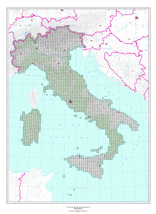 | |
|---|---|
|
|
|
|
| TYPE |
Sections of Series 25 are first carried out by digital or analytical stereo-restitution and after automatically or manually drawn. Sections of Series 25DB are carried out by digital stereo-restitution or from Regional Technical Numerical Cartography derivation. |
| CHARACTERISTICS |
The “Topographic Map of Italy” at scale 1:25.000 consists of 2 different series: Series 25 for sections published until the end of the 90s and Series 25DB for sections published later. Roads, populated places, technological networks, vegetation, hydrography and relief are indicated. Relief is indicated by contours at 25 m intervals, with shading. International and administrative (Region, Province and Municipality) boundaries are delineated. Roads are classified according to the road-bed nature and to the width. Woods: symbols of trees are in black over green filling. |
| SCALE | 1:25.000 |
| FORMAT |
6’N-S by 10’ E-W |
|
ELEMENTS OF THE SERIES |
2.298 Sections; |
| END OF THE SERIES | Production stopped in 2014. |
| TILE | Geographic tile, based on ED 50 Geodetic Reference System. |
| SPHEROID |
Geodetic Reference System for Series 25 is Hayford ellipsoid - European mean orientation. |
| PROJECTION |
UTM conformal projection (Transverse Mercator); |
| KILOMETRIC GRID |
UTM, ED 50 kilometric grid for Series 25. |
| GEOGRAPHICAL GRID SYSTEMS |
Download shapefiles |
